Pett-Merrell Planing Mill
Box Elder Co. | Utah | USA
Watersource: Box Elder Canal
Pett-Merrell Planing Mill
Located east of Sh 13 on 547 E Forest Street, between N 500 E & N 600 E, Brigham City, Utah. Across N 600 E from John Adams Park.
View Larger Map
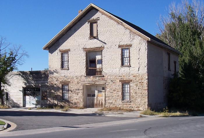
The Planing Mill was built by James Pett in 1875 when the Brigham City Co-op was at its peak. Producing cabinetry and furniture, the planing mill enhanced the Co-op's construction enterprises already in operation. Square nails were also produced at the mill during the cooperative period. Primarily significant as a part of Brigham City's CO-OP from 1875-1892.
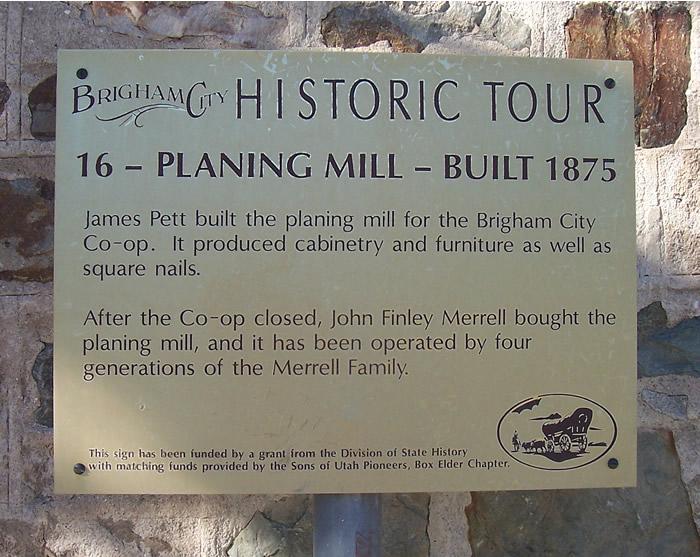
Aurther time of significance was from 1892-1924. John Finley Merrell, who worked at the planing mill for the Co-op, bought it on November 30, 1892. For many years he ran the business in partnership with his sons and sons-in-law, each in charge of a different department.
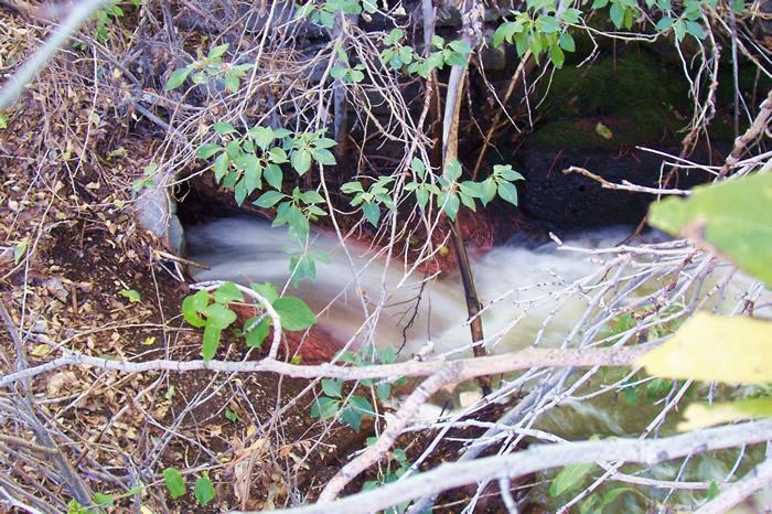
Flow is part of the Box Elder Canal that powered thew mill. The company name was changed, in 1905, from John F. Merrell & Co. to Merrell's Lumber Company. After John F.'s death in 1931, his sons continued the business. It was subsequently taken over by his grandsons, John D. and Paul R. Merrell, who ran the business until 1983 when the planing mill stopped its full-time operation after four generations of Merrell family ownership.
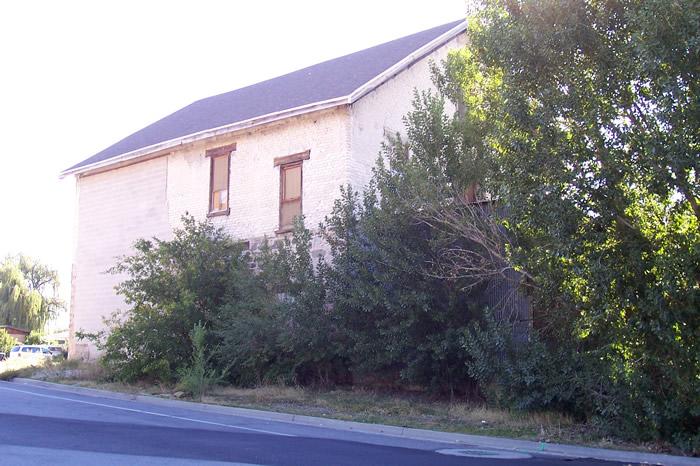
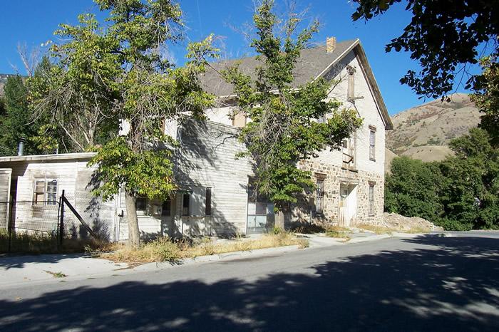
In 1947, a one story frame addition, 40' x 63', was added to the west side of the 55' x 44' two story mill. The SW corner of the addition served as an office, the rest as more work space. A lumber storage shed occupied the NE corner of the original stone mill. Construction is of stone on the first story and adobe brick the second story and half. The mill was turbine powered from the Box Elder Canal. The mill is located on the south end of the block south of John Adams Park.
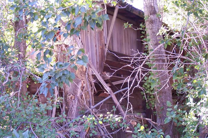
The structure in the photo is part of the lumber storage shed as viewed from the bushes where Box Elder Canal flows under N 600 E Street.The Planing Mill was listed on the National Register of Historic Places in 1990 as part of a multiple listing of Co-op buildings. GPS: 41' 30.63'N, 112' 0.38'W ele. 4,475'/1,364 meters Brigham City Quadrangle
The 2008 Google Maps Street View shows the mill area cleaned up, bushes removed from the N 600E street side so that the stone outlet arch is clearly visible and the front doors were painted white as is also the frame addition to the west. The 2012 Google Maps satellite view shows the mill as a burned out hull, both the stone/adobe section and the frame section. The walls are still standing, but no roof & interior is gutted. A photo by digital treasures came be brought up on Google maps and viewed there of the gutted mill. On May 21, 2011, a 25 year old Utah man pled guilty to third degree felony counts of burglery and attempted arson inregard to the mill fire in the early morning of Nov. 10, 2008. Police stated the the suspect had confessed to the crime when interviewed after his arrest in January 2009. He had earlier denied any connection to the fire immediately after the event.