Akron Mill
Lancaster Co. | Pennsylvania | USA
Watersource: Cocalico Creek.
Akron Mill
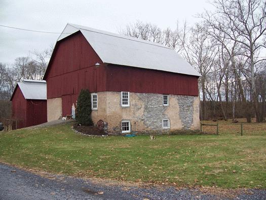
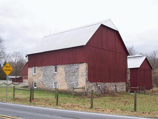
South of US 322 on Pa 272 from the town of Ephrata about 1.5 miles, turn right on Point View Ave. for about 1000', then veer left on Rothville Road and continue one mile, finally turning right on Royer Road. Go on Royer Road to the mill on left (looks like a smaller Lancaster Co. barn) just before crossing the Cocalico Creek.

This mill was thought to have been lost to posterity, since it couldn't be found in a survey conducted by Arthur C. Lord in 1994 as he was gathering information for his book, "Water-powered Grist Mills of Lancaster County, Pennsylvania". It was discovered by Mr. Kinsey in the first part of 2006 while he was looking paticularly for this mill. In a copy of Bridgens Atlas of 1864 - Lancaster Co., one can see that the Akron Mill is exactly where the barn is today and the mill race is on the map just at the locations that can be traced at the present. Interesting!!

The original mill was built in 1762 by & on a land package owned by Charles Hallacker. Carl Harlacker, same person just his name anglicized, owned the mill in 1783. From 1789 to 1826, taxes were paid by either Samuel Harlacker (Hallacker) or the estate thereof. Subsequent owners were: John Graver, 1864; Samuel Royer, 1875; John Stoll, 1883; and George Buch in 1899. The last rebuilding occurred in the 1960's, as it was converted to a tobacco barn by 1969 and couldn't be located in 1994 by Mr. Lord.

Lancaster County ADC Map location of Page 17, J-8. The mill sits on the SW side of Royer Rd. along the SE side of Cocalico Creek just south of the bridge. The property, purchased by the present owners in 1983, was already interiorly refitted as a tobaccco barn, complete with venting, sideing boards that could be pushed out to help dry tobacco. There were, according to the young gentleman at the property, many stencils on the stucco walls that had been removed, some still remained but were difficult to read. The stencils were of brands of flour available for sale.

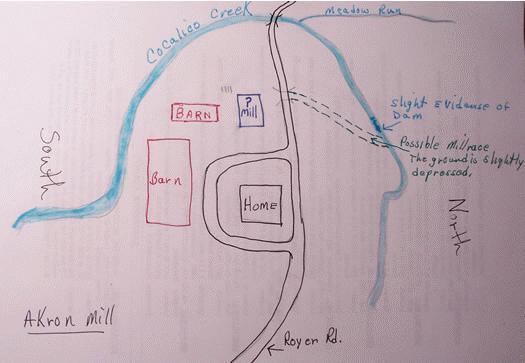
Also about 15' on the roadside of the mill, stones apparently mark a piece of the millrace to the mill from the creek 200' away on the north side of the road. In the 1980's, a small, wooden bridge had been on Royer Road (over the millrace?) aligning with the marker stones and a shallow grove from the north side of the road leading toward the creek as the above homemade map indicates. The headrace would have originally been much deeper in order to have sufficient volume of water to provide enough fall/headpressure to operate a wheel or turbine(s). Subsequently, the headrace filled in as it was probably blocked off at the source and naturally diminished as cattle grazed the area as pasture.