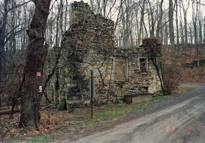
Ruins:Haupt's Oil Mill
Bucks Co. | Pennsylvania | USA
Watersource: Cook's Creek.
Ruins:Haupt's Oil Mill
Go east of Springtown, Pa in Springfield Twp. 1.5 miles on Pa 212. Turn left on Haupt's Bridge Road and procede 0.7 miles to the mill opposite the miller's house at the blocked-off road that used to cross Cook's Cr. on the Haupt's Mill Covered Bridge. This road is no longer open to public traffic since the bridge across the creek was arsoned.
View Larger Map
A smaller 25'X 35' 2.5 story linseed oil mill of the early 1700's. Lindseed oil was processed from flax grown in the area. With the importance of flax, grown as a crop, for clothing manufacture lessening in the mid. 1800's, the mill fell idle and consequently into disrepair and later decay. GPS: 40D 34.12'N, 75D 15.01'W ele 335'/102 meters) Allentown Quadrangle.
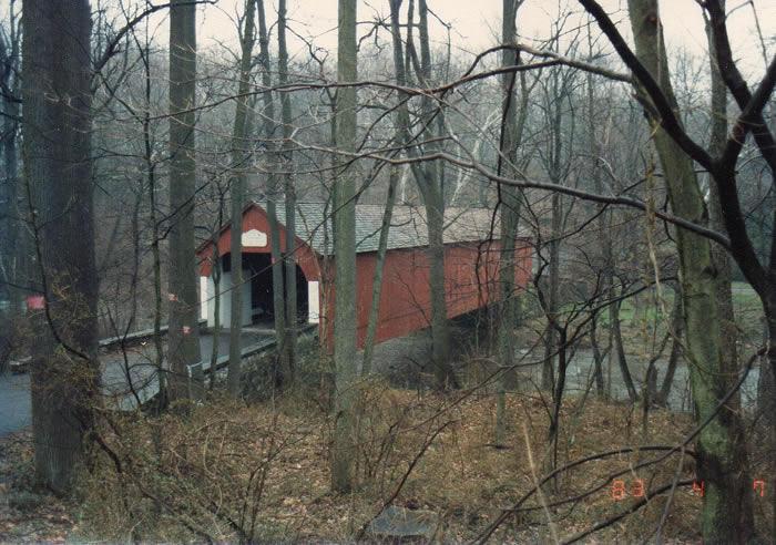
The covered bridge that once stood nearby, was still viable for traffic when it was arsoned in the early to mid. 1990's. The bridge took its name from the mill ruins which are located behind the mill on the left side of the road. The road to the mill via Funk's Mill Road off Pa 412, then onto Haupt's Bridge Road is no longer a road soon after branching off from Funk's Mill Road. The third way by Keleman Road just north of the bridge site and wading the creek would be the closest way to the mill ruins, would still be on private property, other than asking permission to go back the private road from Pa 212.