Buffington Mill
Dauphin Co. | Pennsylvania | USA
Watersource: Tributary of the Wiconisco Creek.
Buffington Mill
From the center of the town of Gratz go west on Specktown Road/Sr 1014 for 1.8 miles to an old one-room school on the right at Shade Road junc. Old Specktown Road/Sr 663 branches off to the left. The road is very short and there is only one house on the south side of the road. The mill is situated behind the house, down a large embankment.
A quiet pastoral scene along the stream, perhaps the Little Wiconisco Creek with the Coal/Thick Mountain ridge in the background.
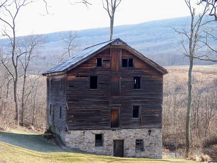
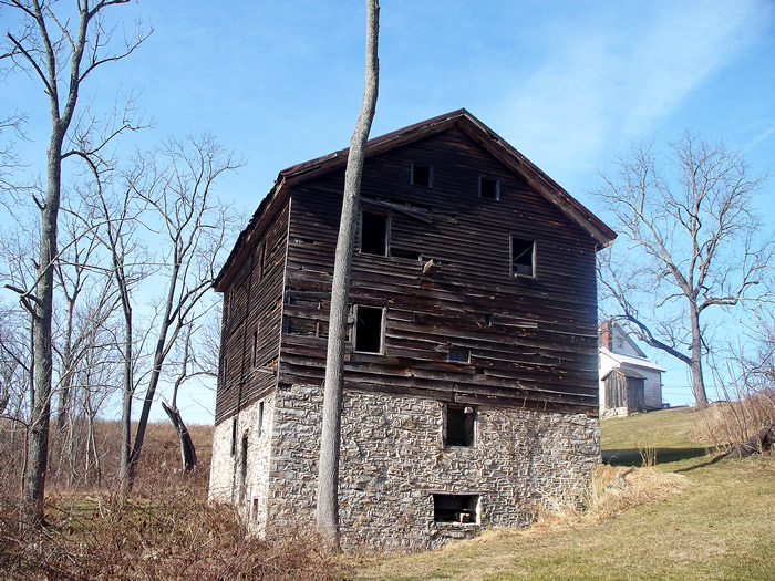
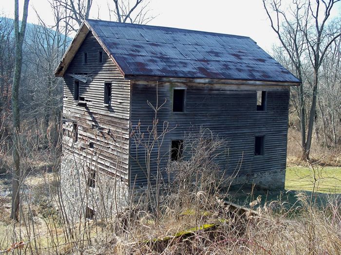
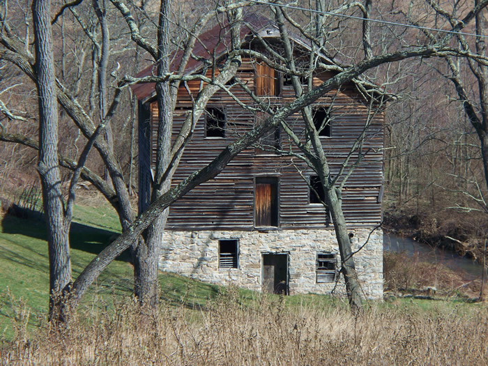
A closer view of the 30'x 40' 3.5 story mill of one story plus stone and foundation and 2.5 stories of log covered by slab siding.
aAnother close view looking up at the front toward the catshead/sack hoist.
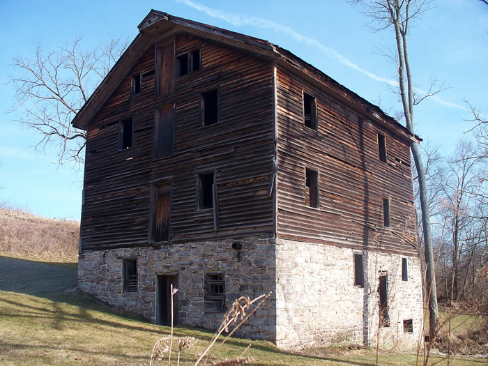
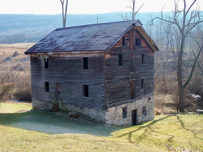
The mill from the opposite end. This end is where the water suppy entered. The windows should really be installed to prevent more damage to the interior.
The rear of the mill with the miller's house beyond up the hill, placed along Old Speckman Road/Sr 663.
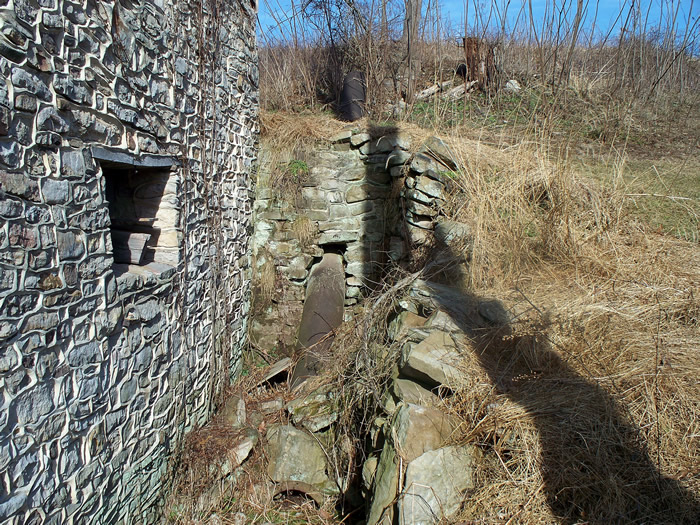
The penstock suppling water to the mill seems awfully low, unless the wheel was an undershot wheel.
The same area looking down on it from a possible millrace/concrete sluicebox.
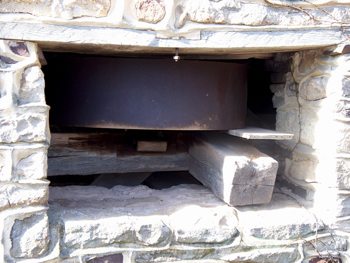
This open hole may be where an external waterwheel was mounted. In later years, a tractor with a belt may have been used to turn the visible steel pulley/drum affixed to a steel or wooden shaft to operate the mill mechanisms.
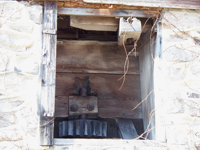
The upper hole in the rear wall/foundation of the mill shows a iron-toothed gear on a steel shaft. The gear transfers power laterally to another gear on a similar shaft. This all seems to be below or part of a hurst frame, the very heavily- timbered framework that holds the millstones. This framework is separate from the mill itself to keep the vibrations of grinding from loosening the mill walls.
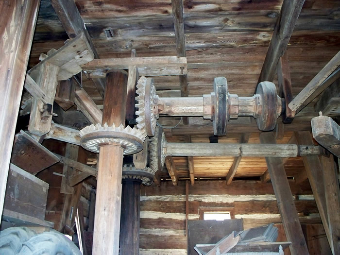
Some wooden shafts and gearing intermeshing with wooden, replacable teeth. Notice the logs walls in the background.
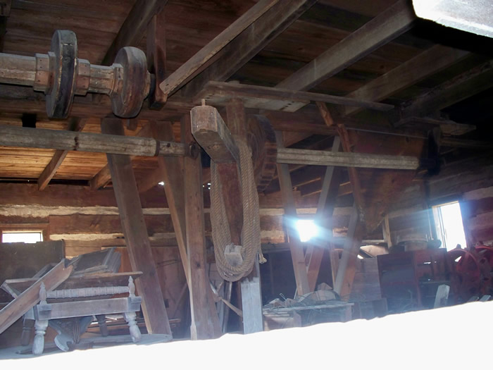
The same wooden line shaft, in the center, with rope coiled around it, is a stone crane, and in the lower left is a millstone set, complete with shroud and fancy wood turnings on the hopper legs.
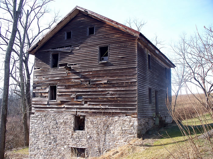
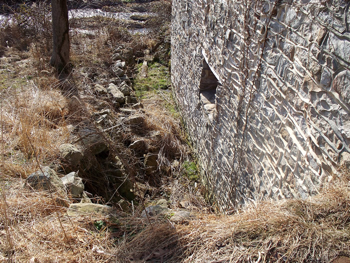
The mill fron above. The high weeds are hiding part of the headrace system.
The mill with the tributary to the Wiconisco Creek below.
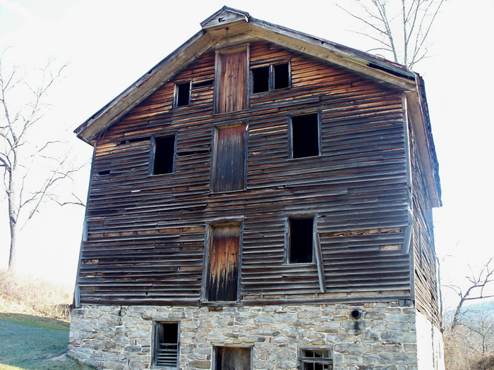
The mill looks a little lonely down there. It definitely needs windows installed to keep out the inclement weather.
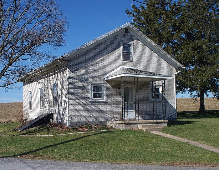
The old schoolhouse on Sr 1014 at Shade Road and Old Srecktown Road/Sr 663 appears on an 1875 Lykens Towmship map for Dauphin Co. The school either dates from that time period or before or has been rebuilt on former school location.
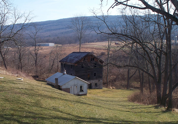
A parting shot of the little valley on the north side of the Coal/Thick Mountain ridge. It is not know what the little building was/is used for. GPS: 40° 35.62'N, 76° 45.13'W 610' elevation